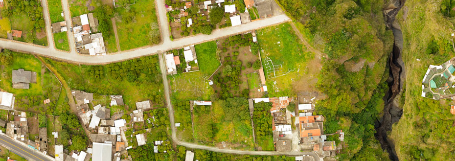
Flatworld Solutions has a long history of analyzing, developing, and delivering high-quality GIS products, applications, and geospatial data in user-friendly formats. We offer a complete range of geospatial services for clients across the globe that range from Geospatial Mapping to Geospatial database Management. Our services are flexible enough to be customized for each client in order to meet their business specifications perfectly.
Outsource geospatial services to Flatworld Solutions for comprehensive solutions that include spatial planning, field data collection, 2D and 3D visualization, remote sensing analysis, data management, and web based mapping applications.
Geospatial Services We Offer
We take precise location based mapping and remote sensing measurements that aid in Orthophoto generation, highway corridor mapping, etc.
We provide exact base map layers for aerial photographs/ GIS products to make sure that the scale of the photograph is uniform, and can be used directly on a map.
Our team offers wide array of GIS solutions that includes digitizing man-made and natural features in the planimetric maps, and scaling them accurately in 2D or 3D formats.
In order to calculate volumes and terrain slopes, we measure elevations at various points using 3D models - these can be topographic, bathymetric or a combination of both.
We create comprehensive topographic maps for the contours with 'Z' values, projection parameters, relief and planimetric details, and also update old topographic maps.
Using Photogrammetric and LiDAR techniques, our experts develop accurate (3D or 2D) surface / terrain models that will help you understand site features better.
We make use of LiDAR digital terrain models to integrate geophysical information for geologically unstable areas like Dams, etc.
This service includes geospatial data collection for geospatial databases and geographical surveys. Also, it includes base map creation, customer indexing, etc.
We provide comprehensive cadastral mapping services whereby you can get all the details of properties in each area. We also scan hard copy maps and digitize them.
Thematic mapping is a statistical map portraying geographic patterns or specific distribution of a demography within a said location.
We use Microstation, AutoCAD, and ArcView to offer parcel mapping so you can keep records of land surveys, ownership, site administration, and more without hiring a specialist on a full-time basis.
Why Choose Flatworld Solutions for Geospatial Services?
Geospatial services require maintaining high levels of precision and accuracy, and ensuring superior quality comes naturally to us. There are several benefits of outsourcing geospatial services to Flatworld Solutions, some of our key differentiators are:
Technology
At Flatworld Solutions, we deliver the unmatched geospatial services that are economical and accurately delivered. Skilled manpower combined with state-of-the-art infrastructure allows us to provide hassle-free services and innovative solutions to our clients.
People
Our experts come from varied backgrounds like statistical analysis, business management, project management, geology, technology, etc. our professionals are backed by many years of experience (between 5 and 20 years) in various critical geospatial applications, which helps us in providing innovative solutions to our clients.
Processes
As a part of our process, we first analyze product delivery workflows and enterprise systems. We then plan to leverage received information to create modern business solutions and new products. All our processes are designed to help you set up powerful business decision support systems, and develop an independent strategic and systems view point.
Specialization
What sets us apart from other companies is that we specialize in geospatial information processes, 2D/3D CAD modeling, and management systems. We work to identify innovations and strategic actions that help you make the most of your investments in geospatial systems.
Outsource Geospatial Services to Flatworld Solutions
Flatworld Solutions is an ideal geospatial technology service provider, not only due to the benefits mentioned above, but because we are capable to deliver highly accurate solutions on time and at most affordable rates. Our solutions do not simply begin and end at executing your requirements; we introduce you to the strategic frameworks and essential policies that underpin industry's best practices and geographic information management policies.
Flatworld Solutions works towards developing practical, relevant, and tailored solutions that incorporate latest geospatial technology and meet all your specifications, including those of your customers. Get in touch with us to outsource geospatial services to Flatworld Solutions, we will be glad to provide you an ideal business solution.
Avail best-in-class services at affordable rates
Our Customers


Key Differentiators
Case Studies
-
Flatworld Solutions provided customized CNC programming using MasterCAM
-
Flatworld Provided CFD Simulation Services to a Leading HVAC Products Manufacturer
-
Flatworld Solutions Offered Mechanical Instrument Drafting and Detailing Services to an Engineering Consultant
-
Flatworld Solutions Offered US Client with 2D to 3D Mechanical Legacy Drawing Conversion
-
Flatworld Solutions Provided Reverse Engineering of Machine Parts to a Client
Join the growth phase at Flatworld Solutions as a Partner
Service distributorship and Marketing partner roles are available in select countries. If you have a local sales team or are a person of influence in key areas of outsourcing, it's time to engage fruitfully to ensure long term financial benefits. Currently business partnerships are open for Photo Editing, Graphic Design, Desktop Publishing, 2D and 3D Animation, Video Editing, CAD Engineering Design and Virtual Walkthroughs.
Reach out to us for a quick direct response from decision makers at the Flatworld Solutions global team.

USA
Flatworld Solutions
116 Village Blvd, Suite 200, Princeton, NJ 08540
PHILIPPINES
Aeon Towers, J.P. Laurel Avenue, Bajada, Davao 8000
KSS Building, Buhangin Road Cor Olive Street, Davao City 8000


