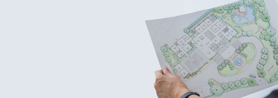
For most civil projects, a map is the starting point. A map is essential to commence a project of any size - be it a small construction work or a large mining/infrastructure project. Mapping is used extensively by the oil and gas industry, the construction industry, landscape architects, surveyors, etc. Traditionally, mapping requirements were fulfilled using conventional surveys. The process required the use of heavy ground equipment and was inherently slow. Later, aerial mapping using satellite imagery came to be used extensively. However, this process was riddled with inaccuracies and is now considered obsolete. To overcome these shortcomings, increasingly, drone mapping services are being used.
Drone 3D mapping services collect data 90% faster than traditional methods and have become widely popular for mapping. Such mapping can produce detailed 2D maps that can be used to fill in the imaging gaps in maps obtained via satellite imagery. Drones equipped with RGB (for photogrammetry) and multispectral/thermal/LIDAR sensors provide high-resolution maps at relatively low costs compared to human-crewed aircraft. Associated software tools help visualise the site in 2D or 3D, undertake measurements, and store data. This information can further be used to generate highly accurate measurements and volumetric calculations.
Our Aerial Mapping Services
Flatworld Solutions offers mapping and GIS services, including geospatial database management. Our services are flexible and can be personalised for every client to meet their specific business requirements.
The mapping services offered include -

Topographic mapping services
For the calculation of volumes and terrain slopes. Flatworld measures elevations at various points with 3D models that can either be topographic or bathymetric or a mix of both.

Planimetric mapping services
We offer a range of solutions, including digitising artificial and natural features in the planimetric maps and scaling them accurately in 2D or 3D formats.

Cadastral mapping services
All the details of properties in each area can be provided. As a part of the mapping services, physical maps can be scanned and digitised.
LIDAR mapping services
In this service, LiDAR digital terrain models are used to integrate geophysical information for geologically unstable areas such as dams.
Why Choose Flatworld Solutions for Mapping Services?
Some of the benefits that you can obtain from our aerial 3D mapping services include -
Affordable Pricing Packages
Our highly affordable and flexible pricing packages suit varied business objectives and budgets perfectly.
Data Security
We are an ISO/IEC 27001:2022 ISMS certified mapping firm and take all steps to handle your data securely.
Superior Quality Services
We provide our clients with error-free mapping services and ensure that they are of superior quality.
Short Turnaround Time
We can deliver high-quality quality mapping and spatial services within a short turnaround time.
Experienced Team
Our team at FWS comprises some of the most talented and skilled mapping experts who take care of all your requests with ease. We are trained to work on the latest and the best mapping software and deliver the best services.
Other Service You Can Benefit From
Outsource Aerial Mapping Services to FWS
Our proven aerial drone mapping services will support your business needs by saving you time, effort, and cost. We come backed by a track record of trusted, high-quality work across geographies for various industries. This has made us the preferred agency for businesses to outsource mapping services.
To drive superior business results, please contact us if you would like to know more about our mapping services and how we partner with our clients as an aerial mapping service provider.
Avail best-in-class services at affordable rates
Our Customers


Key Differentiators
Case Studies
-
Flatworld Solutions provided customized CNC programming using MasterCAM
-
Flatworld Provided CFD Simulation Services to a Leading HVAC Products Manufacturer
-
Flatworld Solutions Offered Mechanical Instrument Drafting and Detailing Services to an Engineering Consultant
-
Flatworld Solutions Offered US Client with 2D to 3D Mechanical Legacy Drawing Conversion
-
Flatworld Solutions Provided Reverse Engineering of Machine Parts to a Client
Join the growth phase at Flatworld Solutions as a Partner
Service distributorship and Marketing partner roles are available in select countries. If you have a local sales team or are a person of influence in key areas of outsourcing, it's time to engage fruitfully to ensure long term financial benefits. Currently business partnerships are open for Photo Editing, Graphic Design, Desktop Publishing, 2D and 3D Animation, Video Editing, CAD Engineering Design and Virtual Walkthroughs.
Reach out to us for a quick direct response from decision makers at the Flatworld Solutions global team.

USA
Flatworld Solutions
116 Village Blvd, Suite 200, Princeton, NJ 08540
PHILIPPINES
Aeon Towers, J.P. Laurel Avenue, Bajada, Davao 8000
KSS Building, Buhangin Road Cor Olive Street, Davao City 8000
INDIA
Survey No.11, 3rd Floor, Indraprastha, Gubbi Cross, 81,
Hennur Bagalur Main Rd, Kuvempu Layout, Kothanur, Bengaluru, Karnataka 560077

