
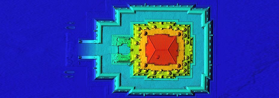
Digital Elevation Modeling Services
Digital elevation models (DEM) are key components in pre-planning and planning phases of many construction and conservation projects. DEMs can be used to facilitate lay-outs of corridor surveys, seismic line locations and well sites, among others. They enable project planners, and logistics and operations managers to ensure project access is optimized for successful fulfilment of project objectives. As a collection of elevation points at regularly spaced intervals, digital elevation mapping can also highlight ridge lines, slope breaks and incised streams, as well as other abrupt changes in the surface formation. It is this regular grid spacing that differentiates a digital elevation model (DEM) from a digital terrain model (DTM), which uses irregularly spaced heights.
Flatworld's Digital Elevation Modeling Services
Flatworld generates digital elevation models in different ways, according to your requirements or constraints. The topographic information required for a DEM can be extracted using photogrammetry and image matching technology for the automated collection of mass points and break-lines. Alternatively, laser and radar-based survey techniques can be used to automatically yield digital elevation data. In particular, Flatworld handles:

Data overlap for the correct joining of digital elevation data and datasets (clip and merge)
Rectification of aerial photography and satellite imagery
Data format transfers, for example from SDTS (Spatial Data Transfer Standard)
When you outsource digital elevation mapping to us, you get our guarantee of quality, cost and deadline satisfaction
Associated Services Include
Advantages Offered By Flatworld Digital Elevation Modeling Services
Data-driven digital modeling offers powerful analysis and eliminates risky guesswork
Improved, more reliable new venture planning
Identify defining terrain characteristics and calculate slopes and volumes for terrains
Model water or land mass movement
3D views from DEM grid data, with production of physical models where required
DEM maps generated in 2D or 3D formats to suit the CAD systems in your enterprise
Serving Civil Engineering Teams with Digital Elevation Modeling and Related Services
While quality is always a key factor, Flatworld services are also flexible in terms of the amount of digital elevation model data used. We apply our technological and expert resources in the most cost-effective way for you. We measure the quality of DEM products and services by the accuracy of the elevation at each pixel and the morphological views. Initial factors affecting quality include terrain roughness, grid resolution/pixel size, and sampling density. Further choices include the degree of vertical resolution and interpolation and terrain analysis algorithms. We work with you to define the optimal mix that brings you the level of detail and quality you need to successfully launch and progress your projects.
To find out more about digital elevation modeling services from Flatworld, contact our executives, they will be glad to assist you. Let's get started!
Live chat with us
USA
Flatworld Solutions
116 Village Blvd, Suite 200, Princeton, NJ 08540
PHILIPPINES
Aeon Towers, J.P. Laurel Avenue, Bajada, Davao 8000
KSS Building, Buhangin Road Cor Olive Street, Davao City 8000
INDIA
Survey No.11, 3rd Floor, Indraprastha, Gubbi Cross, 81,
Hennur Bagalur Main Rd, Kuvempu Layout, Kothanur, Bengaluru, Karnataka 560077
