Struggling to reduce survey costs and field time while capturing aerial topographic data? Our surveying services is the solution to all your drone mapping requirements. When you outsource your drone survey requirements to us, we help you map inaccessible areas and provide you with highly accurate data outputs at reasonable rates.
Our advanced drone sensors and platforms produce clear 3D models and high-resolution mosaic data sets of the areas, which are difficult to access. This leaves you with highly accurate cadastral maps of complex and hard-to-access environments. Our drones can also be integrated into your surveying systems to carry out 3D mapping, land surveys, photogrammetry, topographic surveys and more.
Drone Survey Services We Offer
Being a professional drone surveying company, we extend our aerial drone surveying services to businesses across various industry sectors -

Roof Survey
Our drone roof survey services provide you with a clear view of your roof, which help you to plan your routine maintenance. We follow a highly accurate, non-disruptive and minimal risk process to provide you with accurate data.
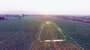
3D Drone Mapping
At Flatworld, we use laser scanning, photogrammetry software, and aerial photogrammetry techniques to carry out drone 3D surveys.

Analysis and Inspection
Our drone site survey professionals leverage high-resolution thermal cameras to perform asset inspection and analysis of solar panels, chimneys, transmission lines and towers, flare stacks and turbines.
Project Tracking & Management
We can help you monitor various projects including highways, roads, railways, industrial corporations and more. We then create geotagged videos with volumetric calculations.

Drone Data Processing
If you already have drone data, then we are equipped to process that data and provide you with clear and accurate output formats such as contours, Digital Terrain Models, point cloud processing, orthophoto and 3D model.

Digital Surface Models
We convert drone images of the areas inspected into digital surface models, in which each pixel specifies the 2D information of the region examined.

Contour Maps
Our drone land survey services provide you with contour maps, which are accurate and make it easy to understand the surfaces captured by drones.

Textured 3D Mesh
If you already have data captured from drone mapping surveys, then we can help you to use that data and reproduce textured 3D mesh. This highlights the vertices, edges, texture and faces of the captured data, which is critical for inspections.
Why Should You Choose Our Survey Services?
Some reasons to choose us include -
Cost Efficiency
By reducing your drafting, designing and turnaround expenses, we assure cost efficiency when you partner with us.
Advanced Surveying Tools
At Flatworld, we leverage advanced drone surveying sensors and platforms to provide you with highly accurate and quality outputs.
Multi-Step Quality Assurance
We adhere to multi-step quality assurance process to ensure the final output is clear and serves your purpose.
Experienced Technical Team
Our team of drone experts are well trained and are capable of catering to complex projects that demand precision and accuracy.
Quicker TAT
With multiple global delivery centers and world-class infrastructure, we assure the quickest possible turnaround time when you outsource your survey needs to us.
Stringent Data Security
Committed to protecting your business data from unexpected intrusions, malicious activities, and unnecessary downtime, we have stringent privacy policies and confidentiality agreements in place.
Other Service You Can Benefit From
Outsource Survey Services to Flatworld Solutions
Offering a comprehensive range of civil engineering services, at Flatworld Solutions we can assist you with anything from true-to-scale drawings and 360-degree tours to drone and ortho-imagery. Delivering high-quality outputs across secure platforms and servers, you can be assured of utmost quality and uncompromised security when you choose us.
It's time to embrace the drone mapping revolution and make the most of this technology. Contact us to know more.
Avail best-in-class services at affordable rates
Our Customers


Key Differentiators
Case Studies
-
Flatworld Solutions provided customized CNC programming using MasterCAM
-
Flatworld Provided CFD Simulation Services to a Leading HVAC Products Manufacturer
-
Flatworld Solutions Offered Mechanical Instrument Drafting and Detailing Services to an Engineering Consultant
-
Flatworld Solutions Offered US Client with 2D to 3D Mechanical Legacy Drawing Conversion
-
Flatworld Solutions Provided Reverse Engineering of Machine Parts to a Client
Join the growth phase at Flatworld Solutions as a Partner
Service distributorship and Marketing partner roles are available in select countries. If you have a local sales team or are a person of influence in key areas of outsourcing, it's time to engage fruitfully to ensure long term financial benefits. Currently business partnerships are open for Photo Editing, Graphic Design, Desktop Publishing, 2D and 3D Animation, Video Editing, CAD Engineering Design and Virtual Walkthroughs.
Reach out to us for a quick direct response from decision makers at the Flatworld Solutions global team.

USA
Flatworld Solutions
116 Village Blvd, Suite 200, Princeton, NJ 08540
PHILIPPINES
Aeon Towers, J.P. Laurel Avenue, Bajada, Davao 8000
KSS Building, Buhangin Road Cor Olive Street, Davao City 8000
INDIA
Survey No.11, 3rd Floor, Indraprastha, Gubbi Cross, 81,
Hennur Bagalur Main Rd, Kuvempu Layout, Kothanur, Bengaluru, Karnataka 560077

