Avail Flatworld Solutions' smart DTM technology and skills for your operational project success.
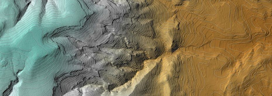
Digital terrain modeling services from Flatworld offer you the production of reports, forms and drawings to meet your requirements as a customer. With our technology and expertise, survey data can also be transformed into a terrain model base to drive instructions for onboard computers in construction and earth-moving equipment. The onboard equipment uses GPS to calculate its geospatial position and from that to locate the appropriate part of the digital terrain model (DTM).
The instructions associated with that location then configure the equipment for the correct operation: for example, cutting a slope of a given angle, length and height. These digital terrain models can integrate new data as it becomes available to track progress compared to estimates and planning. Road construction and larger commercial building projects are examples benefiting from this terrain map and GPS driven approach.
Flatworld's Terrain Modeling Services
As well cost-effectiveness, Flatworld emphasizes accuracy and fast turnaround in its terrain modeling services. Accuracy helps to avoid construction and landscaping rework, which is an additional expense that should be avoided wherever possible. Similarly, timeliness is crucial: otherwise equipment and operators that stand idle mean missed opportunities for income and profitability.
Close collaboration between Flatworld staff and survey teams to generate appropriate survey data
Customization of data processing to support your activities in planning, bidding, monitoring and archiving
Quality control and identification of possible areas of concern though Flatworld expert application of CAD technology
Production of solid terrain models for non-expert/public viewing of construction and landscaping proposals and formations
Associated Services Include
Advantages Offered By Flatworld Terrain Modeling Services
Flexibility in a variety of survey data input accepted, including conventional land survey, ground or aerial LiDAR, and stereo satellite image data
Conversion and cleaning of existing engineering CAD files is required for building enhanced digital terrain models and generating automatic machine control commands
Production of custom 3D surface models and planimetric drawings to customer needs
Clear visualization of earthwork objectives for site teams
Custom reports and alerts help spot potential quality problems or unmet specifications
DTM accuracy from Flatworld saves constructions teams from having to redo work
DTM applications can output data on work accomplished and earth moved for you to then achieve direct monthly invoicing
Serving Civil Engineering Teams With Terrain Modeling and Related Services
A decision to outsource terrain modeling services to Flatworld can be justified in terms of time and money saved, or opportunities that would otherwise have been missed. Quality digital terrain modeling services may not be available to you in-house, but may make the difference between bidding and winning a project - or having to wait for the next one. Flatworld 3D terrain modeling services fit in with your existing resources (initial survey data, for instance) to complete your arsenal of tools and techniques for projects that finish on time and on budget.
To outsource terrain modeling services to Flatworld solutions, contact our executives, they will be glad to assist you. Let's get started!
Avail best-in-class services at affordable rates
Our Customers


Key Differentiators
Case Studies
-
Flatworld Solutions provided customized CNC programming using MasterCAM
-
Flatworld Provided CFD Simulation Services to a Leading HVAC Products Manufacturer
-
Flatworld Solutions Offered Mechanical Instrument Drafting and Detailing Services to an Engineering Consultant
-
Flatworld Solutions Offered US Client with 2D to 3D Mechanical Legacy Drawing Conversion
-
Flatworld Solutions Provided Reverse Engineering of Machine Parts to a Client
Join the growth phase at Flatworld Solutions as a Partner
Service distributorship and Marketing partner roles are available in select countries. If you have a local sales team or are a person of influence in key areas of outsourcing, it's time to engage fruitfully to ensure long term financial benefits. Currently business partnerships are open for Photo Editing, Graphic Design, Desktop Publishing, 2D and 3D Animation, Video Editing, CAD Engineering Design and Virtual Walkthroughs.
Reach out to us for a quick direct response from decision makers at the Flatworld Solutions global team.

USA
Flatworld Solutions
116 Village Blvd, Suite 200, Princeton, NJ 08540
PHILIPPINES
Aeon Towers, J.P. Laurel Avenue, Bajada, Davao 8000
KSS Building, Buhangin Road Cor Olive Street, Davao City 8000
INDIA
Survey No.11, 3rd Floor, Indraprastha, Gubbi Cross, 81,
Hennur Bagalur Main Rd, Kuvempu Layout, Kothanur, Bengaluru, Karnataka 560077


