Are you looking for a drone mapping service provider to outsource drone mapping services? Are you looking for a reliable partner to get efficient drone surveying and mapping? If so, then your search ends here. Drone topographic surveys and maps have taken the world by storm. It helps businesses to be efficient and effective in capturing even the minute details of the property, product, or location for a real time experience.
FWS has a world class infrastructure, equipped with advanced technologies, and experienced professionals to deliver exceptional drone mapping services.
Drone Mapping Services We Offer
We are a leading drone mapping company. Hence, we cater to all and varying requirements of the clients. Here are the major services we offer -

DSM (Digital Surface Model)
Here we use drone images to create DSM models of the captured area. It includes 2D (x,y) and altitude (z) coordinates for easy understanding.
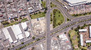
Orth-mosaic Maps
The drone images are rectified to get rid of distortions and put together while post processing to produce accurate orthomosaic maps. The images are in 2D with accurate geo coordinates (x,y) representing accurate distances.
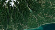
DTM (Digital Terrain Model)
Here, post filtering objects like buildings, the drone maps are used to develop DTMs.

Contour Maps
Based on the project requirement, DTM or DSM can be used to create contour maps that best represent the surface or area captured by the drone.
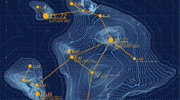
3D Point Cloud
The drones can help generate densified point clouds. Each point in it contains geo (x,y,z) and colour information. It provides accurate area and distance measurements.
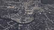
3D Textured Mesh
The edges, vertices, textures, and faces caught by the drone are fine-tuned and reproduced to create the 3D textured mesh. This is vital when the public or external parties are involved to check the maps as it offers great visual inspection.
Why Choose Flatworld Solutions for Drone Mapping?
When you outsource drone mapping to us, you get access to many advantages as mentioned below -
High Accuracy
FWS is a leading and experienced drone mapping service providing company. We ensure that our outputs are 100% accurate and align with client needs.
Faster Data Acquisition
With a huge team of drone pilots' experts and survey grade drones at FWS, we collect drone maps faster than any other competitors in the market.
Advanced Software and Equipment
We are an ISO certified drone 3D mapping company that produces international standard quality output.
Fastest Turnaround
As a top drone surveying company, we work round the clock for drone mapping and surveying to deliver projects before the deadline.
Other Service You Can Benefit From
Outsource Drone Mapping Services to Flatworld Solutions
At FWS, we are 100% committed to delivering world-class drone surveying and mapping services to all clients. We have a large team of drone experts, and survey professionals, own advanced equipment, and the latest software tools to provide quality services. We offer a wide range of drone topographic surveys to help clients meet their targets.
If you are looking for a reliable and trustworthy drone mapping service providing company, Contact Us now.
Avail best-in-class services at affordable rates
Our Customers


Key Differentiators
Case Studies
-
Flatworld Solutions provided customized CNC programming using MasterCAM
-
Flatworld Provided CFD Simulation Services to a Leading HVAC Products Manufacturer
-
Flatworld Solutions Offered Mechanical Instrument Drafting and Detailing Services to an Engineering Consultant
-
Flatworld Solutions Offered US Client with 2D to 3D Mechanical Legacy Drawing Conversion
-
Flatworld Solutions Provided Reverse Engineering of Machine Parts to a Client
Join the growth phase at Flatworld Solutions as a Partner
Service distributorship and Marketing partner roles are available in select countries. If you have a local sales team or are a person of influence in key areas of outsourcing, it's time to engage fruitfully to ensure long term financial benefits. Currently business partnerships are open for Photo Editing, Graphic Design, Desktop Publishing, 2D and 3D Animation, Video Editing, CAD Engineering Design and Virtual Walkthroughs.
Reach out to us for a quick direct response from decision makers at the Flatworld Solutions global team.

USA
Flatworld Solutions
116 Village Blvd, Suite 200, Princeton, NJ 08540
PHILIPPINES
Aeon Towers, J.P. Laurel Avenue, Bajada, Davao 8000
KSS Building, Buhangin Road Cor Olive Street, Davao City 8000
INDIA
Survey No.11, 3rd Floor, Indraprastha, Gubbi Cross, 81,
Hennur Bagalur Main Rd, Kuvempu Layout, Kothanur, Bengaluru, Karnataka 560077

